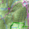
TrekMe - GPS trekking offline4.5.3


Rating

Genre
GAMES

Size
6 MB
Version
4.5.3
Update
Oct 12 2024
TrekMe - GPS trekking offline APK for Android Download. Download now!
 Download
TrekMe is an Android app to get live position on a map and other useful information, without ever needing an internet connection (except when creating a map). It's ideal for trekking, biking, or any outdoor activity.
Your privacy is important as this app has zero tracking. This means you're the only one to know what you do with this app.
In this application, you create a map by chosing the area you want to download. Then, your map is available for offline usage (the GPS works even without mobile data).
Download from USGS, OpenStreetMap, SwissTopo, IGN (France and Spain)
Other topographic map sources will be added.
Fluid and doesn't drain the battery
Particular attention was given to efficency, low battery usage, and smooth experience.
SD card compatible
A large map can be quite heavy and may not fit into your internal memory. If you have an SD card, you can use it.
Features
• Import, record, and share GPX files
• Marker support, with optional comments
• Real-time visualization of a GPX record, as well as its statistics (distance, elevation, ..)
• Orientation, distance, and speed indicators
• Measure a distance along a track
• Be alerted when you move away from a track
For instance, all map providers are free, except for France IGN - which requires an annual subscription.
For professionals and enthousiasts
If you have an external GPS with bluetooth*, you can connect it to TrekMe and use it instead of the internal GPS of your device. This is especially useful when your activity (aeronautic, professional topography, ..) requires better precision and updating your position at a higher frequency than every second.
(*) Supports NMEA over bluetooth
Privacy
During a GPX recording, the app collects location data even when the app is closed or not in use. However, your location will never be shared with anyone and gpx files are stored locally on your device.
General TrekMe guide
https://github.com/peterLaurence/TrekMe/blob/master/Readme.md
TrekMe, a robust GPS trekking app, empowers adventurers with its offline capabilities, allowing them to navigate trails and explore the wilderness without relying on an internet connection. Its intuitive interface and comprehensive features make it an indispensable companion for any outdoor enthusiast.
Offline Maps and Navigation
TrekMe stands apart with its extensive offline map database, encompassing detailed topographical maps for regions worldwide. This feature eliminates the need for a stable internet connection, ensuring seamless navigation even in remote areas where connectivity is unreliable or unavailable.
Route Planning and Tracking
The app's intuitive route planning tools enable users to meticulously plan their treks, incorporating waypoints, landmarks, and elevation profiles. TrekMe meticulously tracks progress along the planned route, providing real-time feedback on distance traveled, altitude gained, and estimated time of arrival.
GPS Tracking and Breadcrumbs
TrekMe's precise GPS tracking accurately records the user's path, creating a detailed breadcrumb trail. This breadcrumb trail serves as a valuable backup in case of disorientation, allowing users to retrace their steps and return to the intended route.
Altitude and Compass
The app's built-in altimeter provides accurate elevation data, helping trekkers gauge their progress and anticipate challenging terrain. The integrated compass ensures accurate orientation, especially in unfamiliar or poorly marked areas.
Weather Forecast and Safety Features
TrekMe integrates weather forecasts to provide timely updates on changing conditions, empowering users to make informed decisions and adjust their plans accordingly. The app also includes safety features such as an SOS button and the ability to share live location with designated contacts, enhancing peace of mind during solo treks.
Additional Features
TrekMe offers a wealth of additional features to enhance the trekking experience. These include:
* POI Database: A comprehensive database of points of interest, including huts, campsites, and water sources, aiding in trip planning and exploration.
* Elevation Profile: Detailed elevation profiles provide insights into the terrain ahead, allowing users to assess the difficulty of the route and plan accordingly.
* Route Sharing: Seamlessly share planned routes with fellow trekkers, enabling group coordination and enhancing safety.
* Export and Import GPX Files: Import and export GPX files for compatibility with other navigation devices and platforms, ensuring seamless integration into existing workflows.
* Customizable Settings: Extensive customization options allow users to tailor the app's functionality to their specific preferences and trekking style.
Conclusion
TrekMe - GPS Trekking Offline is the ultimate companion for any outdoor enthusiast. Its offline capabilities, comprehensive features, and user-friendly interface make it an indispensable tool for navigating trails, planning treks, and ensuring safety in the wilderness. Whether you're an experienced hiker or embarking on your first adventure, TrekMe empowers you to explore the great outdoors with confidence and peace of mind.
1 / 5 ( 171 votes )


